
Table of Contents
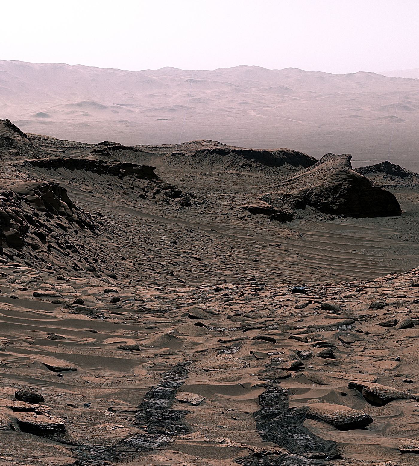
Layered rocks photographed and drilled by a Mars rover are giving geologists a readable history of water that came and went rather than a single ancient flood. In the crater under study, fine sediments alternate with coarser, wind blown layers, a pattern that suggests lakes or slow rivers that dried, were buried by dunes and then returned as conditions shifted. Mineral evidence strengthens the story, with clays and sulphates that form in the presence of water appearing at different heights in the stack, implying changing chemistry as well as changing water levels. For scientists reconstructing the Martian climate, repetition matters. A world that was wet once, briefly, is a different prospect for past habitability from a world where water persisted in cycles over long periods, giving any early chemistry repeated chances. Rover teams read these layers like pages, using the order of strata, cross cutting features and chemical fingerprints to place events in sequence, even without absolute dates. Driving strategy follows the science, steering towards layer boundaries where transitions are recorded most clearly. Each drill sample adds a point of ground truth that orbital images alone cannot provide, anchoring interpretations of landscapes seen across the whole planet.
What the Evidence Shows
Comparing these rocks with sedimentary formations on Earth is essential and humbling, because similar layers can form through different processes and Mars had lower gravity, a thinner atmosphere and different chemistry. Field geologists therefore work through multiple explanations for every pattern, testing them against grain sizes and mineral data the rover returns. The findings also guide the search for preserved organic material, since fine lake sediments that were buried quickly offer the best protection from radiation at the surface. Sample caching decisions weigh exactly these factors, prioritising rocks that record water, habitability and good preservation together. As the rover climbs through younger layers, the record may show when the region finally turned dry for good. That transition, whenever it is pinned down, will be one of the most important dates in understanding how a once wetter Mars became the desert studied today. Engineers plan drives around energy and communication windows, so each stop must balance scientific promise against distance and risk, making the layer by layer record a product of patient operational choices too. Reporting and analysis from sources such as Nature track the same developments, and specialists following layered Mars rocks wet periods say the direction is now consistent across independent lines of evidence.
The Wider Context
The wider context is a research landscape in which replication and open data now decide reputations. Findings connected to layered Mars rocks wet periods are being checked by independent groups with shared datasets, and the teams involved publish their methods in full so rivals can test every step. That discipline is slower than a headline cycle, but it is why results in this area increasingly survive first contact with scrutiny.
What Happens Next
What happens next in the story of layered Mars rocks wet periods will be decided by follow-up work already under way: larger samples, longer observation and instruments that have not yet come online. The researchers involved are unusually united on one point, that the current results justify the next investment of time and money. Readers will not have to wait long for the first tests of that claim. You can follow related developments in our coverage of science.
None of this will be settled by a single announcement, study or product launch. The pattern to watch is accumulation: independent confirmations, honest reporting of failures and steady improvement in the underlying numbers. Readers who follow those signals, rather than the loudest claim of the week, will understand this subject better than most of the commentary surrounding it suggests is possible.
